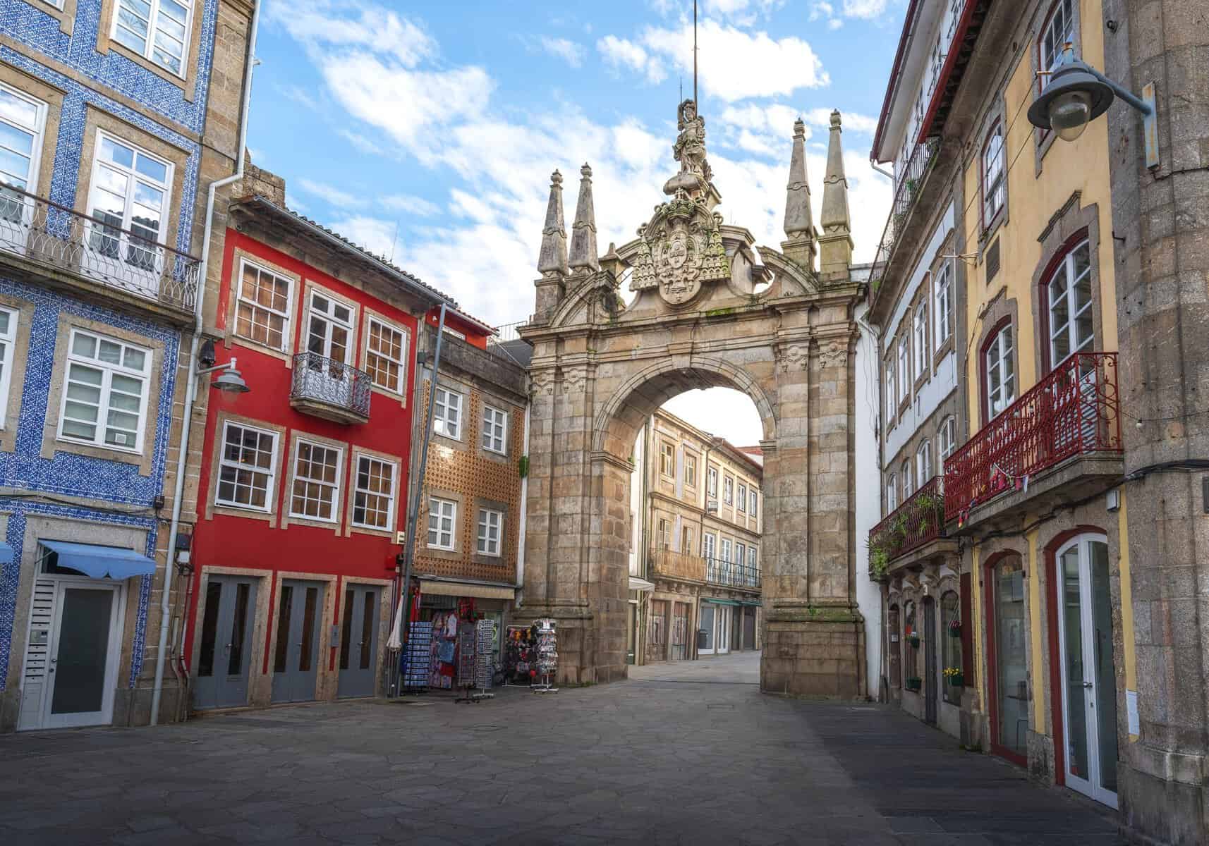
São Jorge is part of the Azores’ central group. The island is shaped like a long, narrow strip stretching 55 kilometers, with a maximum width of 8 kilometers. In essence, the entire island is a mountain rising out of the sea. São Jorge is sparsely populated, and much of it feels almost empty. As you explore, there are moments when it seems as if the island still hasn’t been discovered. Untouched nature appears at every turn, the scenery is dramatic and intensely green, and everything feels wonderfully quiet. While traveling around the island, you’re more likely to see cows than people.
São Jorge is famous throughout Portugal for its cheese. Its other defining feature is the fajãs—small strips of land trapped between the sea and steep, vegetation-covered cliffs. Most of the island’s settlements are concentrated in the south, which also enjoys stunning views toward Mount Pico on the neighboring island—the highest mountain in all of Portugal.
This is an island for travelers in search of absolute quiet, nature, and scenery—especially those who love the feeling of waking up each day to discover a place that seems almost untouched by human footsteps. Most people reach São Jorge as part of a longer, more in-depth trip through the Azores, since it is less accessible and less visited than the main islands. That, of course, is part of its charm.
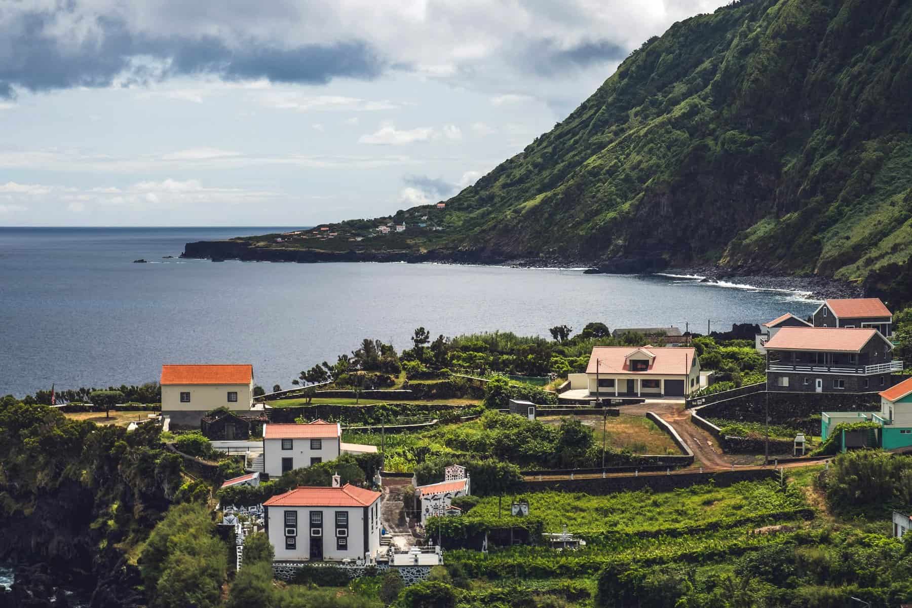
How many days do you need to explore São Jorge?
In principle, two days are enough to see São Jorge, including one hiking trail. Still, anyone making the effort to get here will usually want to cover most of the island’s main sights and routes, and for that, four days is a better plan. Frequent weather changes are also a good reason to keep your schedule flexible.
Click here to find vacation rentals and hotels on the lovely island of São Jorge…
6 sights and experiences worth seeing and doing on São Jorge
- Velas, the island’s capital and main gateway | Velas
- Taste the island’s famous cheese | Queijo São Jorge
- Hike to Fajã da Caldeira, the island’s most iconic site (accessible only on foot) | Fajã da Caldeira
- Basalt pools at Simão Dias | Piscina Natural Simão Dias
- A hiking route through the island’s rounded peaks, with Pico da Esperança as the highest point | Pico da Esperança
- Boat trip along the island’s shores, with dolphins and whales in season
How to get to São Jorge?
Flights to São Jorge?
São Jorge has a tiny airport near the town of Velas, simply called São Jorge Airport | Aeródromo de São Jorge. Unsurprisingly, the small airfield (code SJZ) was built on a fajã because level ground was needed.
The airport has regular flights only to the Azores’ two larger islands: nearby Terceira (a 30-minute flight) and São Miguel, the main island (a 55-minute flight). Both routes are operated by the Azores airline using small aircraft. Tickets usually cost a few dozen euros each way.
Ferry to São Jorge
Most ferries to São Jorge come from the nearby islands of Pico and Faial. In fact, the ferry from Pico can almost be seen as an attraction in itself, since the crossing takes about an hour and feels like more than just transportation. The ferry ride to Horta on Faial takes around two hours.
In general, ferries are best used for traveling between these three islands. The ferry to São Miguel, on the other hand, is long and usually not worth it.
Rental car on São Jorge
A rental car is the most practical way to explore São Jorge, as it gives you the freedom to reach the island's hidden gems that buses don't serve.
The island’s terrain is among the most mountainous in the Azores, and some of the roads are unpaved. Driving here is not especially easy, particularly for anyone unaccustomed to a manual transmission. As in much of Europe, most rental cars here are not automatic. That doesn’t mean you can’t drive on the island—just that it’s worth knowing what to expect and planning accordingly. On the bright side, as on many of the smaller Azorean islands, the roads are very quiet.
Rental car prices on São Jorge are higher than on the larger islands of Terceira and São Miguel, as is generally the case on the less populated islands of the archipelago.
Click here for a private tour of São Jorge with hidden corners and fascinating scenery…
Click here for an amazing tour of São Jorge’s fajãs and viewpoints…
Click here to find hotels on the lovely island of São Jorge…
Good to know about São Jorge
- São Jorge lies about 20 kilometers south of Faial and Pico. Together, the three islands form a kind of triangle.
- From São Jorge’s southern side and western tip, there are wonderful views of Pico Island and its towering summit (unless it’s especially rainy and overcast).
- São Jorge is one of the most heavily forested islands in the archipelago. Around the island, you can still spot steel cables running down the mountain toward the sea. They were once used to lower tree trunks to the harbor for shipment as raw material for shipbuilding and construction.
- The island’s northern side is made up almost entirely of cliffs that plunge sharply into the water, so settlement is concentrated almost entirely in the south, especially around the capital, Velas.
- The island has just over 8,000 residents.
The fajãs – coastal plains
- Over the years, parts of the island’s cliffs collapsed in rockslides into the sea, creating small coastal plains known as fajãs (Fajas without the accent).
- Here on São Jorge, these strips of land developed into biosphere spaces cut off from the mainland by cliffs and surrounded by the sea on three sides. That is why São Jorge’s fajãs were recognized by UNESCO as unique natural sites. There are more than 40 of them on São Jorge, and they are the island’s defining feature.
- Beyond their natural beauty, the fajãs were and still are areas where farming developed and small villages were established, thanks to the fertile, flat ground. Incidentally, Madeira, Portugal’s other island destination, also has fajãs.
- Visitors to the island are especially drawn to the trails along the northern cliffs, some of which descend to the fajãs.
Weather on São Jorge
- Temperatures almost never rise above 77°F (25°C) and rarely drop below 50°F (10°C). In that sense, the island is excellent for exploring.
- The challenge is that São Jorge is very rainy, so apart from May through August, the island is almost always gray and moody. Even in summer, rain is common—just much less so.
- Never head out for a day of exploring on São Jorge without a rain jacket. Even if it looks sunny, the weather can change within minutes.
- Strong winds are also part of daily life here. That’s true across much of the Azores, and São Jorge especially so because of its narrow, mountainous terrain.
Useful information about São Jorge
- Food and alcohol are relatively affordable on São Jorge. Fuel is expensive, but distances are short, so it doesn’t make much difference to your budget.
- From a tourism perspective, the island still hasn’t really been “discovered,” and not many people make it here. That has its pros and cons.
- One of the downsides is weak internet reception in parts of the island, including on Google Maps. It’s worth preparing before setting out on hikes.
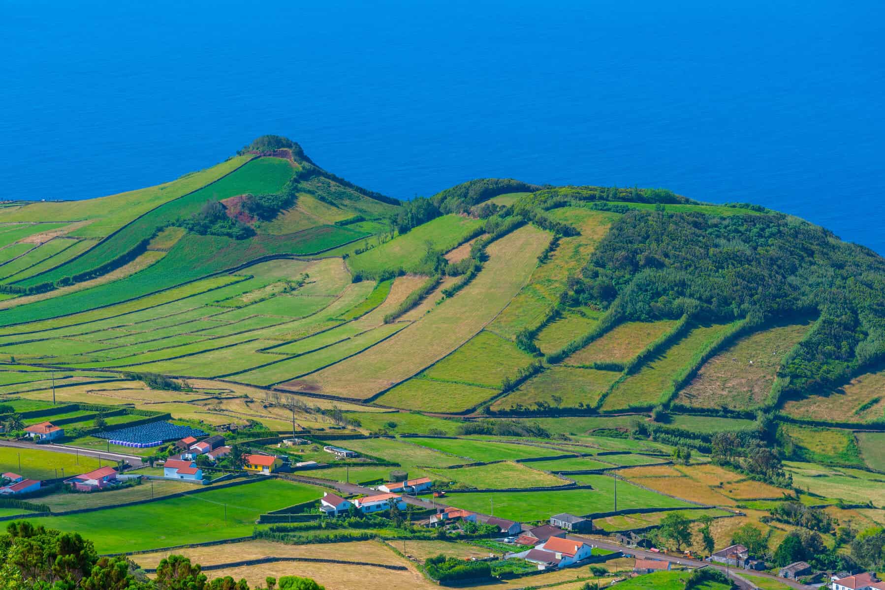
The town of Velas – the capital of São Jorge
Velas (pronounced Velash) lies on the island’s southern coast, like most settlements on São Jorge, and also very close to its western tip.
The town developed around a small natural harbor soon after the island was discovered, and today it is the largest settlement and is considered the capital of São Jorge. It has around 5,000 residents, nearly 70% of the island’s total population.
Velas is home to São Jorge’s ferry port and the small airport. It also has the island’s largest hotel – Hotel São Jorge Garden. Velas is the only place on the island where you’ll find a relatively large supermarket and other modern facilities.
Click here to search for a place to stay in scenic Velas…
The town’s narrow, picturesque streets feel calm and unhurried. As from much of São Jorge’s southern coastline, Velas has excellent views of Mount Pico on the neighboring island on clear days. Despite several earthquakes and volcanic eruptions over the course of its centuries-long history, a number of historic buildings have survived, and there are several spots worth visiting:
- Sea Gate | Portão do Mar – a gate built in the late 18th century as part of the fortifications that protected the town. It stands right by the descent from the ferry dock at the harbor and was once closed every night to prevent unwanted entry into town.
- São Jorge Church | Igreja Matriz de Velas de São Jorge – a stunning church built with basalt stone, just outside the harbor. It was originally built in the 15th century and has undergone several changes since then, mainly after earthquakes. Above all, it’s worth stopping by to see the paved square around the church, which feels like a masterpiece of mosaic work, with stars, dragons, and more.
- Velas Municipal Garden | Jardim Municipal de Velas – one of Velas’s symbols is this small town garden, just uphill from the harbor. It is best known for the bandstand at its center with its red roof.
- Botanical Garden | Jardim Botânico – a small garden higher up in town with especially lush greenery. It’s worth visiting mainly for the view of the sea and Pico Island in the distance, which looks magnificent from here—again, only on clear days.
- The small waterfront promenade along the shoreline – it begins just west of the ferry dock, beyond the tiny bay. As usual, it is beautifully paved in the Portuguese style.
- The natural rock arch | Arco Natural de Velas – at the end of the promenade stands an arch of basalt rock, shaped over the years by wind and water erosion. It rises directly above the sea, and in summer locals often jump into the deep water from the rocks around it.
- Viewpoints – the town climbs quickly up the mountainside and is surrounded by it on all sides. As a result, many points along the roads east and west of Velas make excellent lookouts. From them, you can see the town as well as Pico Island with its giant mountain directly opposite.
- Football field | Campo de Futebol das Velas – this isn’t really a tourist attraction, but it’s worth walking to the western edge of town to see what might be the most beautifully located soccer field in the world. It sits right above the sea, with Mount Pico prominent on the horizon and the blue water creating a striking contrast with the land.
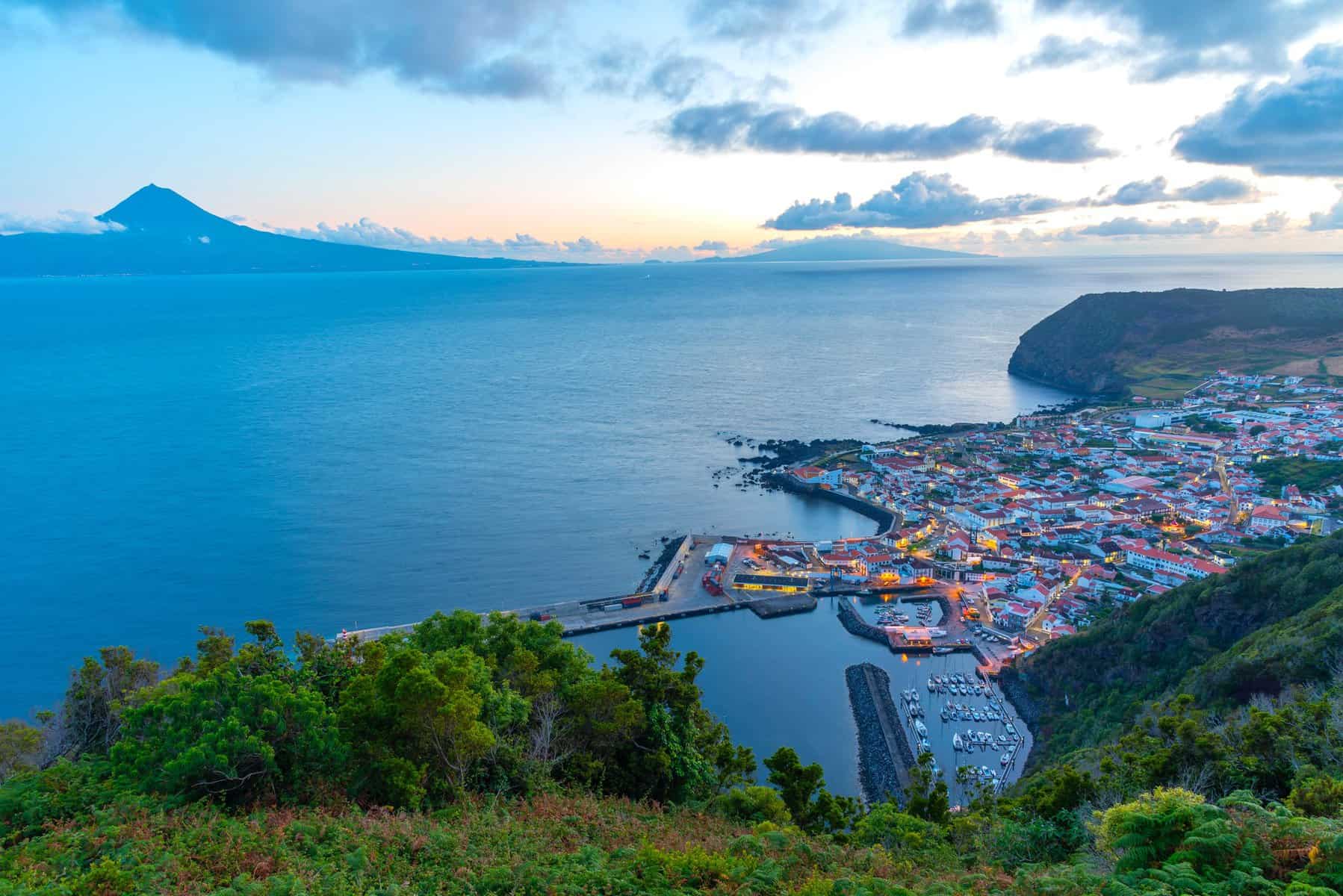
Attractions and interesting places on São Jorge
Fajã da Caldeira do Santo Cristo
This fajã, also known as Fajã do Cristo, is a coastal plain whose far end forms a huge natural pool bordered by the sea. Rainwater flows down from the mountain into the fajã and fills the lagoon with fresh water. At high tide or during storms, the fresh water mixes with the salt water from the ocean, creating a unique biosphere.
These waters are home to the island’s famous shellfish, a prized local delicacy for which São Jorge is known (bivalves).
There is no road access to Fajã da Caldeira – only on foot or by ATV, which usually transport passengers rather than being rented out. Most visitors reach the fajã by hiking there, and it is the most popular hiking route on São Jorge.
If you’re planning a visit to the fajã, it’s important to bring food and water with you. There are places to buy food and drinks in the fajã itself, but they are not always open, and there is nothing along the way.
A beach has formed around the fajã, making it a refuge for surfers. It is also a religious pilgrimage site for island residents, but more than anything else, it is one of the most photogenic places in the Azores.
Within the fajã stands a church (Santuário do Senhor Santo Cristo), an important religious site on the island. In the past, and still today, island residents make pilgrimages—quite literally on foot—to the church. In that sense, it recalls other Christian pilgrim routes to remote sacred places, such as the one that developed to Santiago de Compostela in northwestern Spain.
Click here to find a place to stay in Velas…
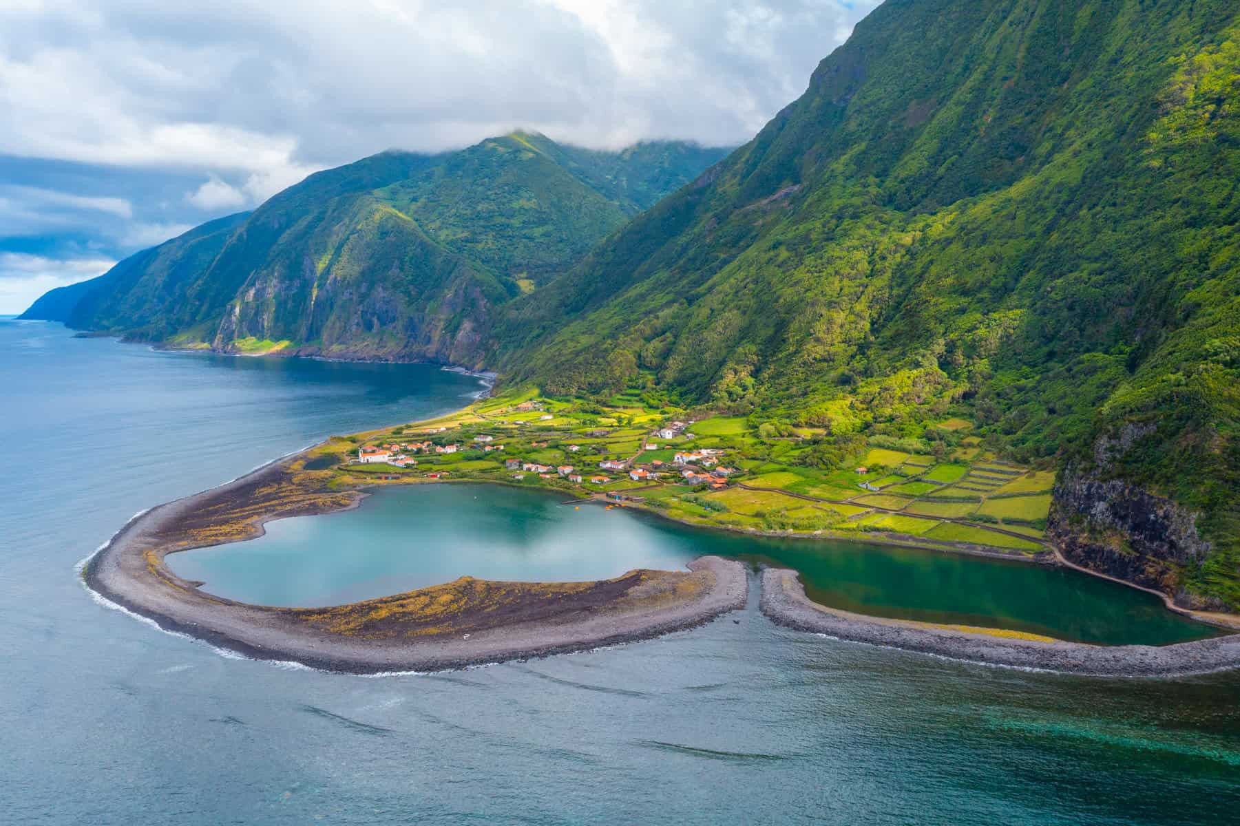
This fajã (in Portuguese, pronounced fajan) may not be the most famous—that title belongs to Fajã da Caldeira—but it comes in second. Unlike its better-known sister, it is accessible by car, which makes it the most visited fajã on São Jorge.
Although there is a village here, fewer than ten people live in it year-round. The other houses are vacation homes belonging to families who once lived here and now reside either in Velas or elsewhere in the Azores and beyond.
Beneath cliffs rising about 300 meters, this strip of land formed over time through rockslides and erosion. What makes it special is the lake within it, complete with a few tiny islands of its own.
At Fajã dos Cubres, as at Fajã da Caldeira, a unique ecosystem developed, largely because it is exposed to the tides, which occasionally fill the lake with salt water that mixes with fresh water flowing down from the mountain. Unlike Fajã da Caldeira, however, there really is a lake here that is not open to the sea, so the biosphere is slightly different.
When you arrive at the fajã, you park near the small church (Ermida de Nossa Senhora de Lourdes). From there, walking paths lead into its distinctive natural setting. As you wander, green cliffs seem to tumble down toward the sea on every side.
At the edge of the fajã are also the remains of an old flour mill from the early days of agricultural settlement here.
Click here for an amazing tour of São Jorge’s fajãs and the island’s spectacular viewpoints…
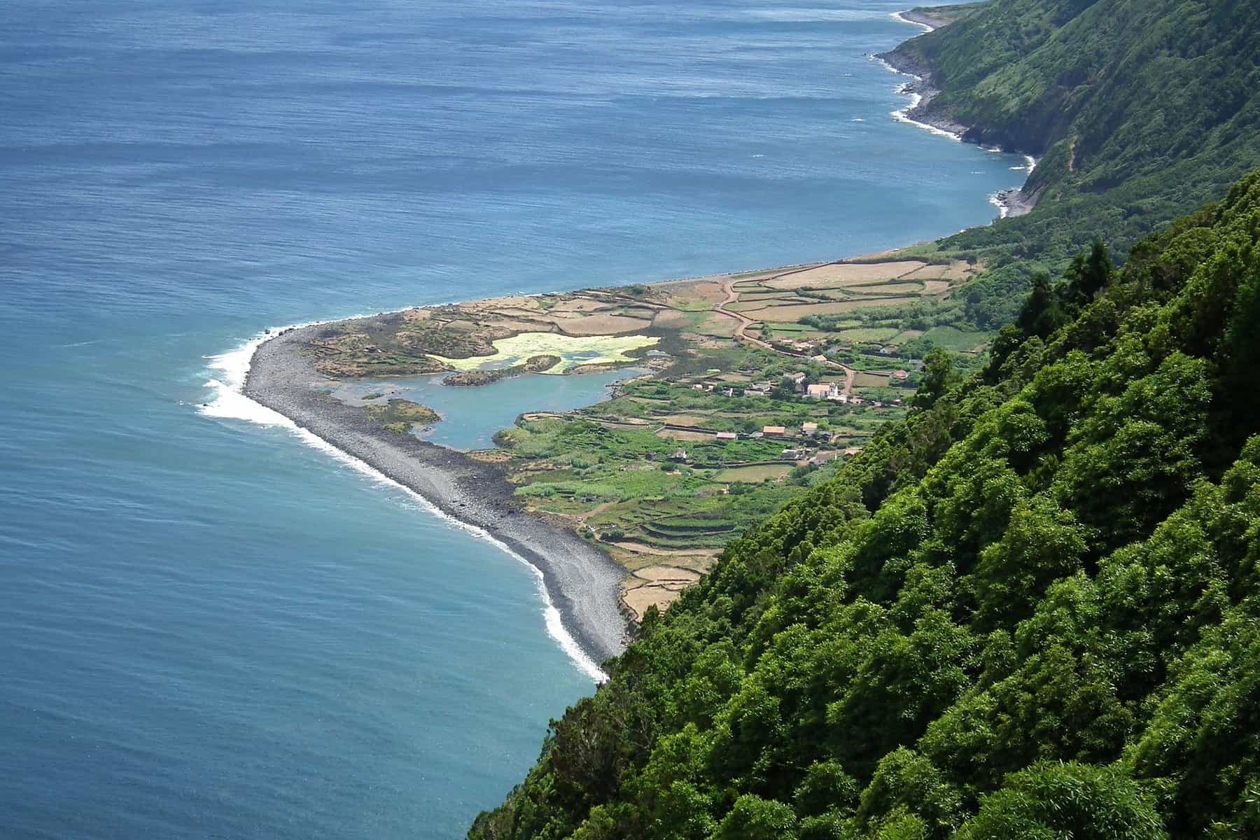
The hiking trail: Sierra do Topo – Fajã dos Cubres – Fajã da Caldeira
This route begins on the eastern side of the island and, after 10 kilometers, reaches Fajã dos Cubres, passing the iconic Fajã da Caldeira along the way.
This is the most popular hiking trail on São Jorge, and it is considered moderately difficult.
It is also possible to do only the final section, closer to the fajãs, which are the island’s most distinctive sites.
Click here to find a place to stay on São Jorge…
Basalt pools at Simão Dias | Piscina Natural Simão Dias
This site is also known as Fajã do Ouvidor | Fajã do Ouvidor.
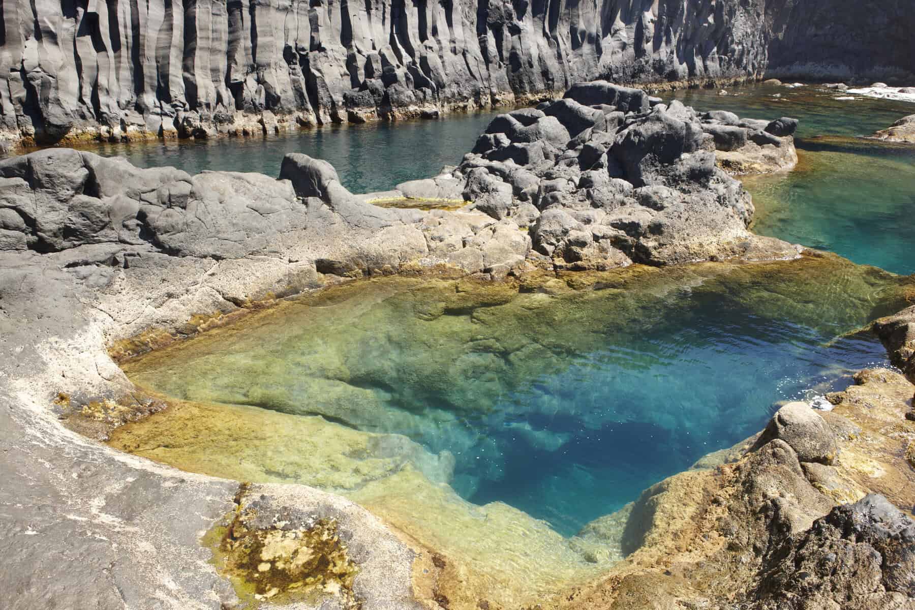
This is one of São Jorge’s natural wonders! On the island’s northwestern side lies a small village on an especially rocky fajã. Here, however, the land could not be used for its main purpose—farming—because the dramatic rock formations remained in place.
Those remarkable rock formations also created natural sea pools where you can swim on warm days. There are pools on both sides of the headland: the ones on the right are more organized, while those on the left are completely wild. The left, or western, side is also where the most striking rock formations are found.
Some of São Jorge’s boat tours pass by this unusual rocky coastline, and from the water it looks even more spectacular.
Click here for a comprehensive guided tour of São Jorge…
The town of Topo
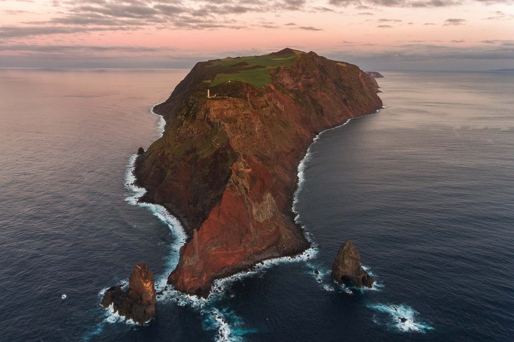
The spot where the lighthouse stands at the island’s eastern tip is one of the most beautiful lighthouse settings in the Azores. It is worth driving here even if there were no lighthouse at all—simply for the scenery and the gusting winds that seem to come from every direction.
The islet 400 meters offshore is called Ilhéu do Topo, and in summer sheep graze there, surprisingly enough. That’s because on an island famous for excellent cheese production, no grazing land goes to waste.
This was the first area settled on the island, back in the 15th century, when Flemish settlers (the Netherlands was under Spanish/Portuguese influence at the time) arrived under the leadership of Wilhelm van der Hagen. Back then, Topo was also the island’s main settlement.
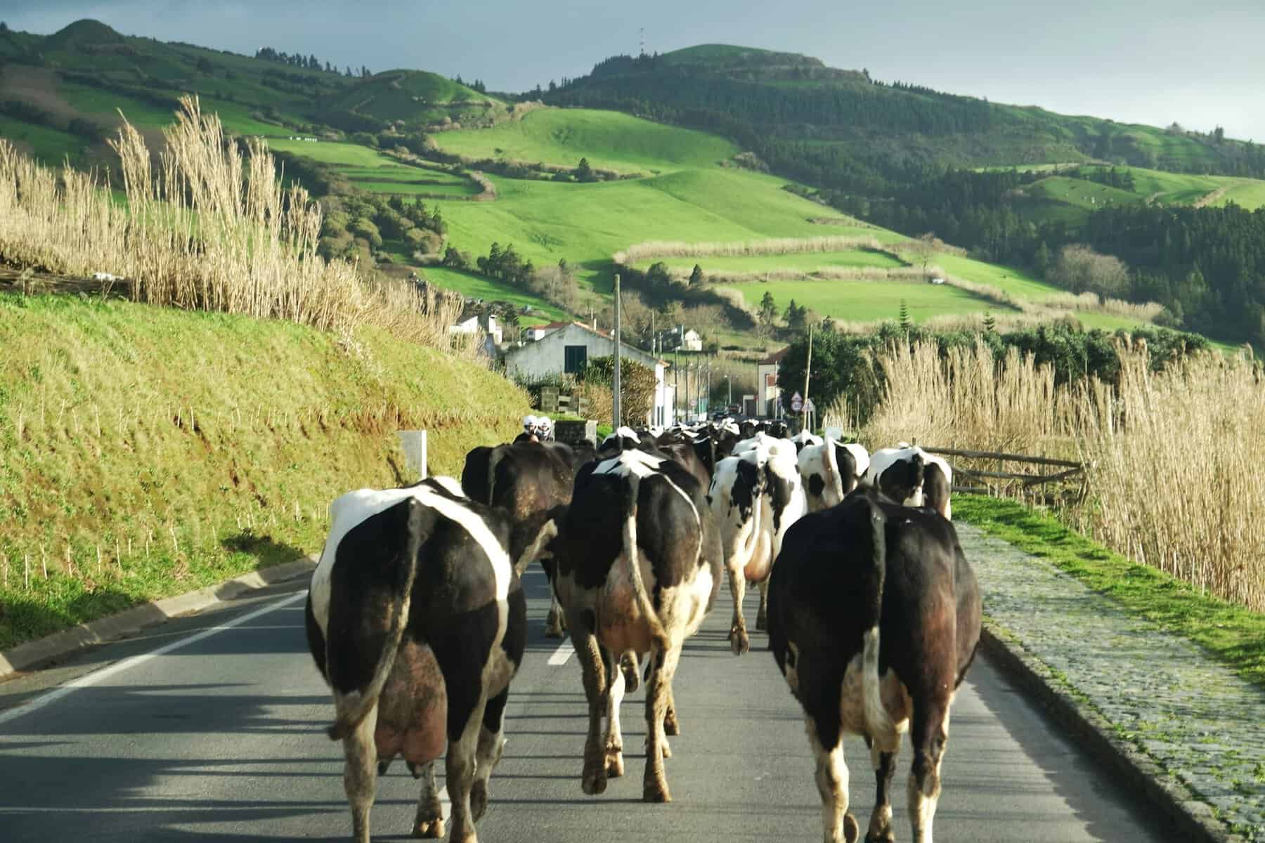
Today it is a small, sparsely populated village with plenty of cows grazing nearby—another remnant of the Flemish era. Signs of that richer past can still be seen in a few old manor houses and in the old Rosário Church (Nossa Senhora do Rosário).
The small old harbor, now used by fishermen, was the island’s main harbor in the early settlement period. It lies south of the headland, surrounded by red volcanic earth.
As soon as you leave the village, the road—as so often on São Jorge—begins climbing quickly into the mountains. Up in the Sierra do Topo, the island’s most popular hiking trail begins, leading to the famous fajãs on the north coast.
About a 10-minute drive west of Topo, there is a waterfall in the middle of dense vegetation that spills into a small natural pool called Cascata do Cruzal. It is well worth stopping to see.
Click here to find a place to stay on São Jorge, the island of exceptional cheese…
Pico da Esperança and the ridge trail | Pico da Esperança
This is the highest point on the island, rising to nearly 1,100 meters. Given how narrow São Jorge is, that is especially impressive. You can’t drive all the way to the summit, but you can get close and continue on foot.
There is a hiking route along São Jorge’s peaks, which are not jagged summits but rounded hills between green pastures dotted with cows.
The trail begins at Pico da Caldeirinhas, which lies to the west. Along the way there are several more “picos,” or peaks, all above grassy depressions covering small craters in the ground. You will almost certainly come across cows, and even if you don’t, the views in every direction are reward enough.
Click here for a wonderful tour to São Jorge’s spectacular viewpoints…
Sete Fontes Forest Park | Parque Florestal das Sete Fontes
A park and forest in the northwestern part of the island, not far from Fajã de João Dias. In Portuguese, the name is pronounced roughly “Sete Fontes.” The park surrounds a lake and is filled with trees and flowers. It makes a lovely stop on the way to or from the island’s north side.
The town of Calheta
Calheta and the villages around it form the second-largest settlement area on São Jorge after Velas. Like most communities on the island, it lies along the southern coast. Naturally, it is still a very small town, but it does have a small harbor for boat trips along the coast, as well as a museum and a few other sights.
Francisco de Lacerda Museum | Museu Francisco de Lacerda
The museum beside the small harbor in Calheta presents the local history of São Jorge. It is housed in a restored former fish cannery that has been turned into exhibition spaces and activity areas.
It includes displays on the island’s traditional agriculture and the industries that grew from it, along with items related to local customs and religious festivals. Since there are not many places like this on the islands, it is worth stopping in for an hour, especially if it is raining outside.
The natural pools of Calheta | Piscinas Naturais Fajã Grande
These are the natural pools of Fajã Grande, located at the western edge of Calheta. Beyond the pools themselves, which are suitable for swimming only on a sunny day, there is also a sort of channel—a concrete path that runs between the rocks and extends into the sea. Walking along it gives a vivid sense of life on a volcanic, basalt island.
Click here for rental cars deals in Portugal and São Jorge…
The village of Manadas
A lovely village between Calheta and Velas, its highlight is the 18th-century Church of Santa Bárbara (Igreja de Santa Bárbara), a small church above the shoreline. Built with local basalt stone, the church is especially charming, and inside it is richly decorated as well.
The village itself is tiny and offers a glimpse of life in the Azores, which even today remains wonderfully calm and, you could almost say, removed from the rush of the wider world. It’s easy to imagine what life here must have been like before the Industrial Revolution.
Click here to find a place to stay on São Jorge…
Boat trips on São Jorge
One of São Jorge’s special experiences is taking a boat trip. Many locals have small boats of their own, and in some accommodations the hosts even offer outings on their personal boats.
Velas in particular has several agencies offering trips in the waters around the island. Because São Jorge is small and not heavily visited, most excursions are private or in very small groups, unlike on the larger Azorean islands.
A basic boat trip usually lasts two to three hours and follows the marine life around the island while also showcasing São Jorge’s unique geology. The island really does look like one long mountain breaking sharply into the water on nearly every side. And yes—during the season, it is rare to go out on a trip without seeing dolphins and whales.
Weather is a major factor for any boat trip in the Azores, so flexibility is essential, because very often you can’t head out exactly when planned.
It’s also important to dress warmly, because it is almost always chilly on deck, and windy too.
Click here for a small-group boat trip around São Jorge…
The western tip of São Jorge and dos Rosais lighthouse | Farol dos Rosais
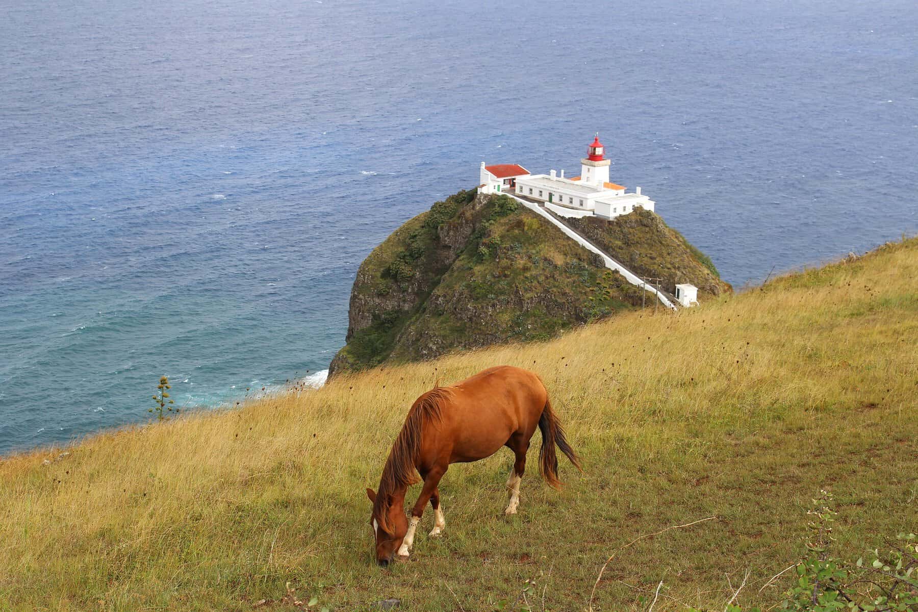
A lighthouse was built above the island’s high western tip in the late 1950s. It stands on cliffs 200 meters above the sea and was once considered the most modern lighthouse in all of Portugal.
It was designed in the style of older lighthouses, with houses below it where lighthouse keepers and their families could live. After a strong earthquake struck the island in 1964, it was abandoned. It was later restored and reoccupied, but by the 1980s it had been automated. Its brief period of operation in the old traditional pattern is another reminder of how quickly the world has changed, especially in recent decades—changes that even the quiet islands of the Azores have not escaped.
The lighthouse itself is modern and not as romantic as many others in Portugal. You can still reach it today, although some of the views are partly blocked by vegetation. Shortly before you get there, there is a higher viewpoint from which you can see the lighthouse, the island’s tip, and the endless ocean beyond.
Click here to find a place to stay on São Jorge…
The cheeses of São Jorge | Queijo São Jorge
On the wetter, cooler islands of the Azores—compared with places like Tenerife and Madeira—the weather is ideal for raising cattle and sheep. Because the green grass of the Azores never seems to stop growing, it keeps the cows well fed and highly productive, and that abundance of milk has been turned into excellent cheese for centuries.
Of all the islands, São Jorge cheese is the most highly regarded. The semi-hard and hard cheese that bears the island’s name is internationally known and especially famous throughout Portugal.
Two main reasons lie behind São Jorge’s cheese-making tradition. The first was the Flemish (Dutch) settlers who arrived on the island in the early days of settlement and brought with them a tradition of cattle raising and hard-cheese production. The second, as mentioned, is the excellent grass that grows on this rainy island, especially in its higher elevations, since São Jorge is essentially one long mountain.
Cheese carrying the “São Jorge Cheese” label must be produced exclusively from the milk of cows that graze on the island itself. Each year, close to 2,000 tons of cheese are produced by a small number of cooperatives on the island. They collect milk from nearly 800 local farmers, a sign of just how important cheese is to the economy of an island with only about 8,000 residents.
Cheese production began in the 15th century, from the very start of settlement, partly as a way to preserve surplus milk. By the late 18th century, the cheese had taken on its current form: a wheel weighing between 8 and 12 kilograms.
The aging process for regular cheese lasts about 4 to 5 months, while the finest cheeses are aged for three years. The cheese is made from unpasteurized milk.
You can visit a small number of cheese-making sites on the island, but more than anything else, the cheese is served and sold just about everywhere.
Click here for more information about São Jorge’s famous cheese…
Click here to find a place to stay on the green and distinctive island of São Jorge…
Click here for an amazing tour of São Jorge’s fajãs and the island’s spectacular viewpoints…