A map is one of the most useful tools for planning a trip and navigating once you arrive. We’ve put together a selection of essential maps highlighting major landmarks across Portugal, as well as in its main cities and top travel destinations.
You’ll find here:
- Map of Portugal’s most popular destinations
- Map of Portugal’s main travel regions
- Map of Lisbon
- Map of Porto
- Map of the Algarve
- Map of Central Portugal – everything between Lisbon and Porto
- Map of Madeira
- Map of the Azores
- Map of São Miguel – the main island in the Azores
Portugal, the wonderful country at the southwestern edge of Europe, is not especially large, but it is remarkably diverse. It is divided into three main regions, which also shape its travel destinations: Center, South, and North, along with the two Atlantic island groups of Madeira and the Azores. Portugal’s two largest urban centers, Lisbon and Porto, are destinations in their own right, and each can easily fill an entire vacation on its own. We’ve prepared maps for every major travel region in Portugal, complete with landmarks, photos, and explanations, so you can explore with ease throughout your stay.
Map of the most popular destinations in Portugal
Portugal offers an enormous amount to see and do, so unless you have plenty of time, it’s hard to fit everything into a single trip. The good news is that you can still cover many of the highlights in each region, since distances are relatively short. In just a few days, for example, you can explore Lisbon and head out beyond the city to Sintra, Cascais, Óbidos, and Cabo da Roca. This map shows the locations of 13 of Portugal’s most popular destinations to help you start planning your trip:
Click here for our Complete Guide on Where to Visit in Portugal…
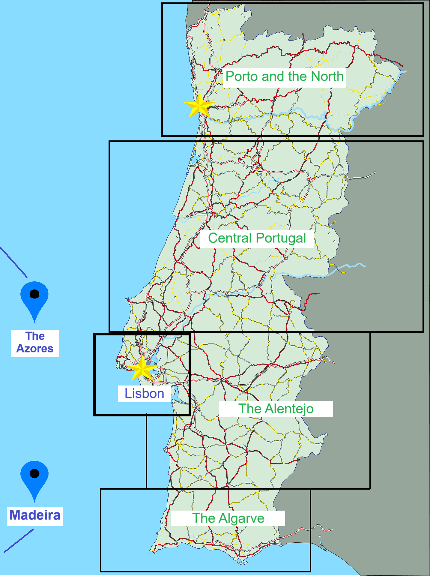
Map of Portugal’s travel regions
This map outlines Portugal’s main geographic regions. Trips that cover more than one area usually head either north or south from Lisbon. A route between Lisbon and Porto, for instance, will pass through Central Portugal, with one or several stops along the way, such as Nazaré and Coimbra. Traveling south from Lisbon to the Algarve will usually include a stop in Évora or the Costa Vicentina nature reserve on the way to the beaches of Portugal’s far south.
Click here for more details on Portugal’s main travel regions…
Map of attractions in Lisbon
Lisbon, the capital, is a lively and captivating city with plenty to see, do, and experience. On the interactive map we created, you’ll find the main attractions in Portugal’s capital. Click on any landmark to view a photo and a short explanation of the site.
Click here for more articles and information about Lisbon…
Map of attractions and sights in Porto
Porto is one of Portugal’s great gems, and it was in and around the city that the Kingdom of Portugal was founded nearly 1,000 years ago. Porto is beautiful not only because of its distinctive topography, but also thanks to its colorful historic buildings, carefully designed by some of the leading architects of their time. The city itself is not large, so you can see quite a lot in a short stay, yet most people who arrive are in no hurry to leave. On this interactive map, you’ll find the locations of Porto’s most important attractions and sights:
Click here for a complete guide to Porto…
Map of the main beaches, towns, and attractions in the Algarve
Portugal’s far south, the Algarve, also known as Faro after the region’s largest city and capital, remained somewhat overlooked until a few decades ago. As the southern coast of Spain grew into a major tourism success, the Portuguese also recognized the potential and began developing their own southern coastline, famous for its abundant sunshine. Today, the Algarve attracts millions of visitors, especially from Northern Europe and especially in summer, drawn by the endless beaches, striking landscapes, countless attractions, and huge shopping centers. Unlike neighboring Spain, the Algarve still feels less commercialized, and the atmosphere remains true to its local character: peaceful, relaxed, and wonderfully easygoing. On this map, we’ve marked the best seaside towns and many of the Algarve’s top attractions:
Check out our Complete Guide to Where to Stay in the Algarve…
Click here for information about Faro, the capital of southern Portugal…
Map of the most popular sights in Central Portugal
Central Portugal is more or less everything between Porto and Lisbon. The vast Alentejo region south of Lisbon can also be thought of as part of the broader heart of Portugal, with its forests and wide grazing fields. Central Portugal is home to several historic religious sites, surf towns along the coast, and a handful of mid-sized cities. On any trip between Porto and Lisbon, or the other way around, it’s well worth stopping at two or three places along the route to experience a more rural side of Portugal. On this map, we’ve marked the best places to stop during a journey through the heart of Portugal, which typically leads to or from Porto or Lisbon.
Click here for more articles and information about Central Portugal…
Check out our list of the Best Places to Visit Between Lisbon and Porto: 15 Top Attractions…
Map of attractions and sights on Madeira Island
Madeira is reached by air from Lisbon, Porto, and other cities in Northern Europe, with direct flights to this warm, green island in the Atlantic. Madeira is not a large island, but its contrasts are dramatic: a capital city that feels fully modern – Funchal, a warm and sunny south, a green, rainy, windswept north, and a mountainous center with peaks rising above the clouds. All of that fits into roughly 30 km across by 10 km long. This charming, almost tropical island offers a wide range of hiking trails, whale-watching cruises, good food and wine, and greenery in every direction. On this map, you’ll find the most interesting attractions and highlights on Madeira Island:
Click here for more information and articles about Madeira Island…
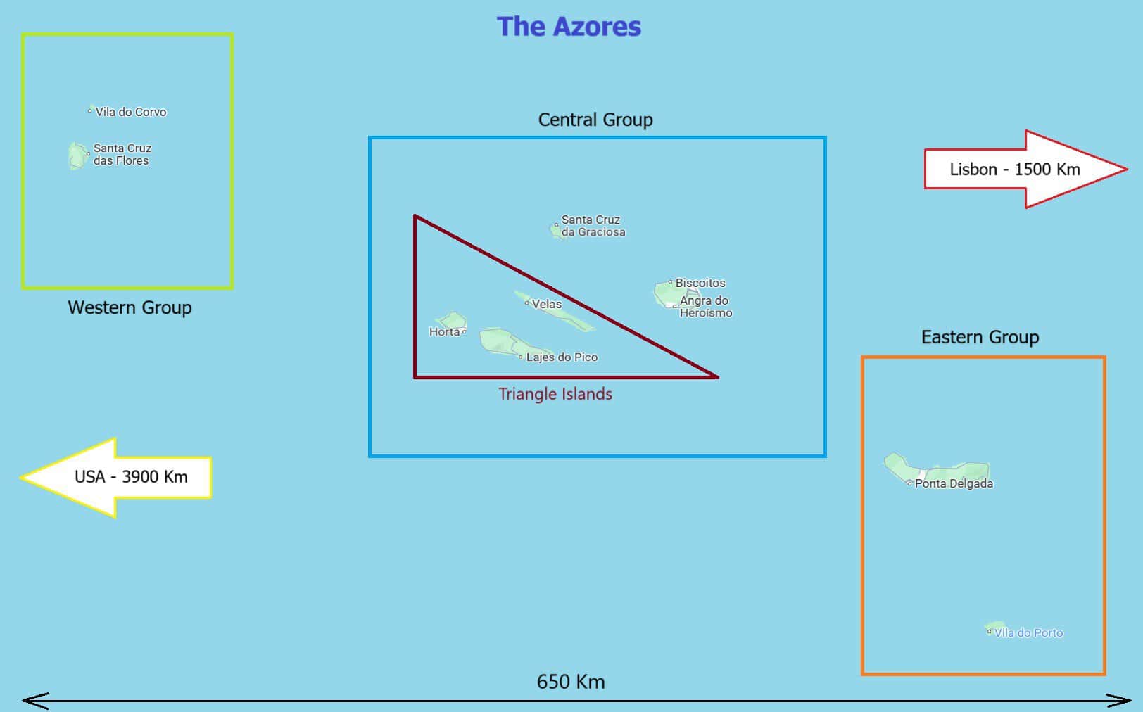
Map of the Azores
The Azores are among the most remote places from any mainland anywhere in the world. These nine islands lie about 1,500 km off the coast of Portugal, already not so far from America, and they make for a truly distinctive destination. São Miguel, the largest island, is the main gateway for most visitors, who usually continue from there to the other, much less populated islands. The islands are lush, volcanic, and deeply peaceful. Portugal’s highest mountain is here on Pico Island, Faial Island is home to one of the world’s most famous marinas, and Terceira Island hosts an annual festival every June. On this map, you can see the location of every island in the archipelago.
Click here for the complete guide to the Azores…
Map of São Miguel – the main island in the Azores
São Miguel is the main and largest island in the Azores. In fact, many visitors to the Azores land in or arrive through its capital, Ponta Delgada, and explore only this island. You can easily spend 4 to 5 days here without getting bored for a moment. It also serves as a convenient base for visiting the other islands in the Azores, thanks to the frequent flights that depart from here.
Click here for the complete guide to São Miguel Island…